The key Landmarks along the Kallang River PCN
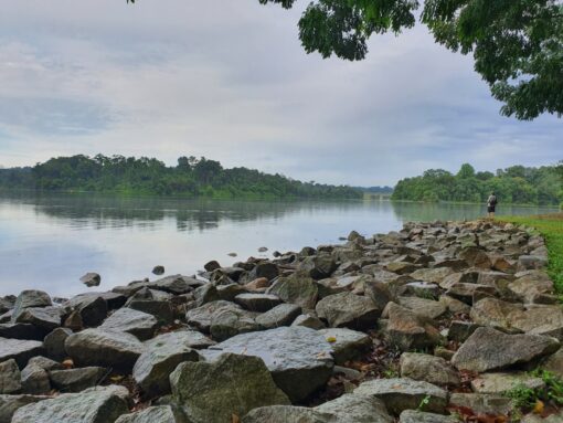
The Lower Pierce Reservoir Car Park is a great meeting and start point. There is ample car park space and the location is serene and beautiful. It is appx 500m away north of the entrance to the Bishan – Ang Mo Kio Park.
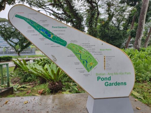
The Upper Thomson Road entrance to the Bishan – Ang Mo Kio Park is near the junction of Ang Mo Kio Ave 1 and Upper Thomson Road. This park is very well landscaped and the Kallang River runs parallel to the park.
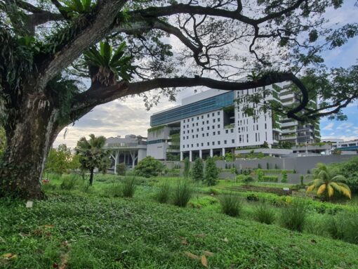
The Eunoia Junior College has a commanding view of the Bishan – Ang Mo Kio Park and the Kallang River. It is located near the junction of Sin Ming Ave and Marymount Road.
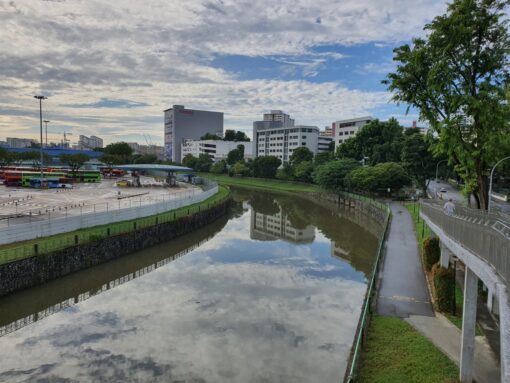
SBS Transit has their massive bus terminal at the junction of Braddell Road and Kallang River. The PCN runs opposite the SBS Transit Terminal.
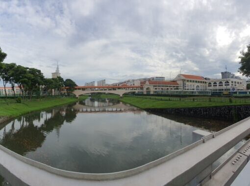
The St Andrews Campus which houses the Primary, Secondary and Junior College is unique as it operates on both sides of the Kallang River and there is a bridge which connects the Campus. The Rugby Fields are prominent on both sides of the river.
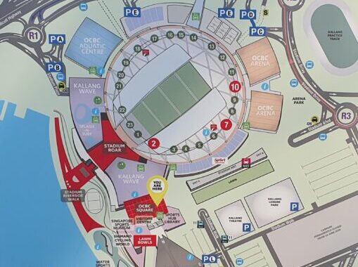
The National Stadium is the Go-To Place for all major sporting and entertainment events in Singapore. It is located at the mouth of the Kallang Basin where the Geylang River meets the Kallang River before flowing into the Marina Bay.
Lower Pierce Reservoir to National Stadium
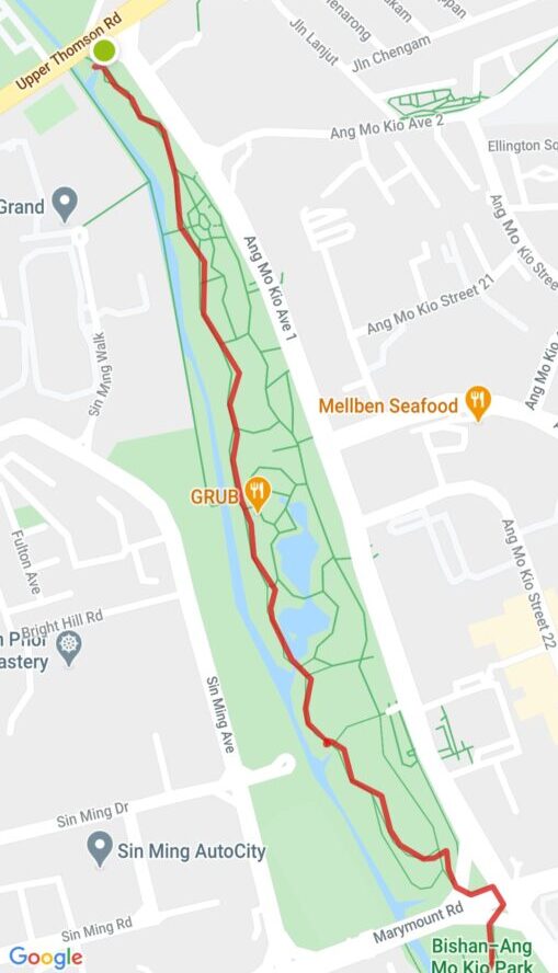
Walk 500m south of the Lower Pierce Reservoir Carpark to the junction of Upper Thomson Road and Ang Mo Kio Ave 1 to enter the Bishan – Ang Mo Kio Park. Follow the PCN till you reach Marymount Road.
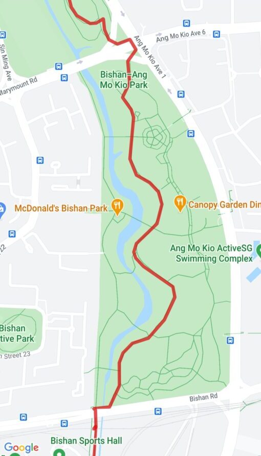
Cross at the Traffic Light junction of the Marymount Road and Ang Mo Kio Ave 1. Follow the PCN till you reach Bishan Road.
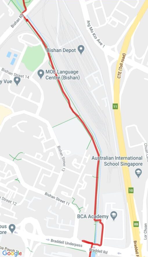
Take the Overhead Bridge to cross the busy Bishan Road where you will see the Bishan Sports Hall on your right and the SMRT Bishan Depot on your left. Follow the PCN till you reach Braddell Road.
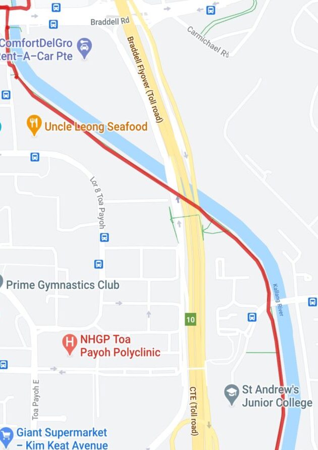
Braddell Road is a major highway and to cross it, must use the Overhead Bridge to get to the Toa Payoh section of the Kallang River. Follow the PCN till you reach St Andrews Junior College. Use the Bridge to cross to the St Andrews Secondary School.
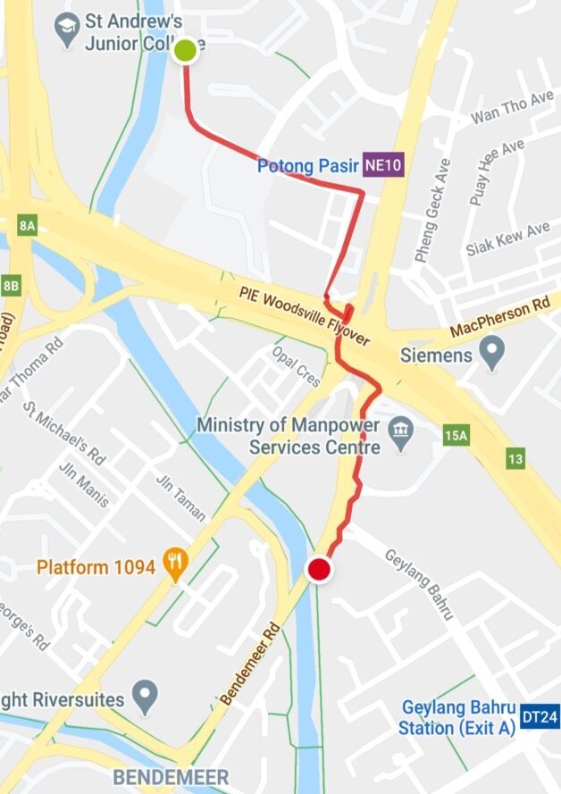
From St Andrews Secondary School, follow the PCN till you reach the Bendeemer Road / Kallang River junction. Do be careful when crossing the massive multi-highways at the Serangoon Road / Upper Serangoon Road / Macpherson Road / Bendeemer Road junction.
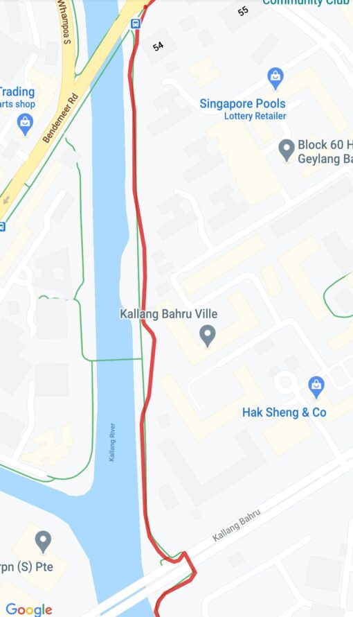
From Bendeemer Road, follow the PCN till you reach Kallang Bahru.

Cross Kallang Bahru at the Traffic Light junction and follow the PCN till you reach Boon Keng Road. Cross at the Traffic Light junction and follow the PCN till you reach Kallang MRT Station.
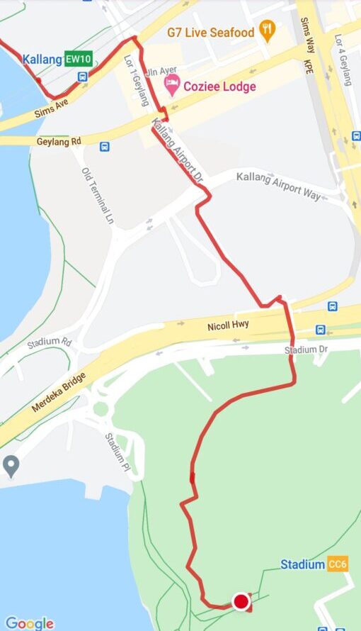
Cross Sims Ave and then Geylang Road at the Traffic junction. Look for the PCN signages that leads to National Stadium. Cross the Nicholl Highway via the Overhead Bridge that leads to the National Stadium.
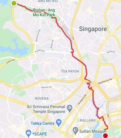
The Kallang River flows from the Lower Pierce Reservoir to Kallang Basin, a distance of appx 15km.


nice article thanks for the info very helpful